Datoteka:Lake turkana satellite.jpg
Izvor: Hrvatska internetska enciklopedija
Veličina ovog prikaza: 800 × 593 piksela. Ostale razlučivosti: 320 × 237 piksela | 640 × 474 piksela | 992 × 735 piksela.
Vidi sliku u punoj veličini ((992 × 735 piksela, veličina datoteke: 618 KB, <a href="/index.php/MIME" title="MIME">MIME</a> tip: image/jpeg))
| Ova je datoteka sa stranica Zajedničkog poslužitelja Zaklade Wikimedije i smiju je rabiti drugi projekti. Opis s njezine stranice s opisom datoteke prikazan je ispod. |

|
This map image could be re-created using vector graphics as an SVG file. This has several advantages; see Commons:Media for cleanup for more information. If an SVG form of this image is available, please upload it and afterwards replace this template with
{{vector version available|new image name}}.It is recommended to name the SVG file “Lake turkana satellite.svg”—then the template Vector version available (or Vva) does not need the new image name parameter. |


Sažetak
| Opis |
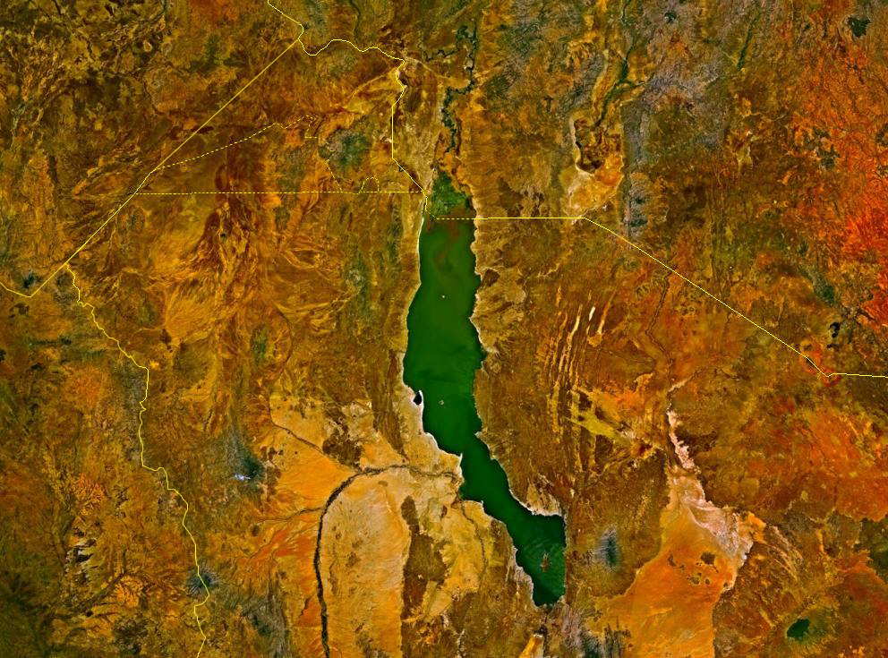
Deutsch: Satellitenbild des Turkana-Sees auf den Staatsgebieten von Kenia und Äthiopien. Die Staatsgrenzen sind als gelbe Linien eingezeichnet. Im Nordwesten befindet sich das sowohl von Äthiopien und Kenia, mindestens bis zur Unabhängigkeit des Südsudan auch vom Sudan, beanspruchte Ilemi-Dreieck.
English: Lake Turkana, Kenya and Ethiopia. satellite image. The yellow lines denote the borders. |
| Izvor | NASA World Wind |
| Autor | Fotografija: NASA |
Licencija
| This image is in the public domain because it is a screenshot from NASA’s globe software World Wind using a public domain layer, such as Blue Marble, MODIS, Landsat, SRTM, USGS or GLOBE.
|
 |
Povijest datoteke
Kliknite na datum/vrijeme kako biste vidjeli datoteku kakva je tada bila.
| Datum/Vrijeme | Minijatura | Dimenzije | Suradnik | Komentar | |
|---|---|---|---|---|---|
| sadašnja | 14:23, 18. kolovoza 2017. | | 992 × 735 (618 KB) | Mélomène | According with [https://en.wikipedia.org/wiki/Ilemi_Triangle] |
Poveznice
Na ovu sliku vode poveznice sa sljedećih stranica: